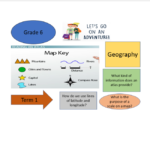
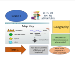
Grade 6 Term 1 Geography teaching and learning the curriculum
R345.00
Use, by you or one client, in a single end product which end users are not charged for. The total price includes the item price and a buyer fee.
Resource Description
The content taught covering the curriculum for term 1 focuses on the following objectives:
1. Classify the information provided by an atlas
2. Analyse the purpose and significance of lines of latitude and longitude
3. Demonstrate how to use lines of latitude and longitude
4. Interpret the purpose of a scale on a map
5. Categorize the various types of map scales
6. Apply a map scale to assess straight-line distances between cities on a world map
Informal assessment and Project-based activities and memo in preparation of formal assessment are included
The informal assessment activities focus on all level of skills developed and assessed
The informal assessment and project-based activities can be used in preparation of formal assessment by the educator, learner and parent.


 KES(KSh)
 USD($)
 GBP(£)
 GHS(₵)
 NGN(₦)
 MUR(₨)
 BWP(P)
 AUD($)
 TZS(Sh)
 INR(₹)
 PHP(₱)
 AED(د.إ)


